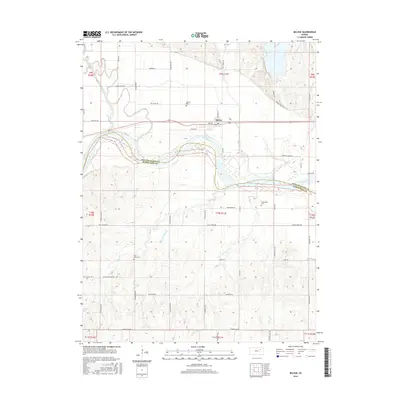
2016 Map of Belvue
USGS Topo · Published 2016About this map
Belvue lies at the heart of this landscape, situated just north of the wide, winding course of the Kansas River. This map details the intersection of regional history and geography, where the Pottawatomie Co and Wabaunsee Co line follows the river's channel. The area's legacy is preserved in several local burial grounds, including Belvue Cem, Greenwood Cem, and Saint Johns Cem. The landscape is defined by the convergence of several waterways into the main river valley, such as Vermillion Creek, Lost Cr, and Wells Cr. Notable road names like Oregon Trail Rd and Old Post Rd hint at the historic transportation corridors that once passed through these bluffs. Further south, rural routes like Strowigs Mill Rd and Kansa Rd weave through the hilly terrain, marking the footprints of long-established farmsteads and rural industry.
Find a feature on this map
45 named features on this map. Tap any name to fly to it.
Don’t see what you’re looking for? This feature index may not catch every label — zoom into the map to look around manually.
Map Details
Editions of this 2016 Belvue Map
This is the sole edition of this map. No revisions or reprints were ever made.
Other maps of this area

1889 · Wamego
USGS Topo · 1:125,000

1894 · Wamego
USGS Topo · 1:125,000

1953 · Wamego
USGS Topo · 1:24,000

1953 · Maple Hill
USGS Topo · 1:24,000

1953 · Belvue
USGS Topo · 1:24,000

1953 · St Marys
USGS Topo · 1:24,000

1954 · Alma
USGS Topo · 1:24,000

1954 · Mc Farland
USGS Topo · 1:24,000

1955 · Manhattan
USGS Topo · 1:250,000

1956 · Manhattan
USGS Topo · 1:250,000