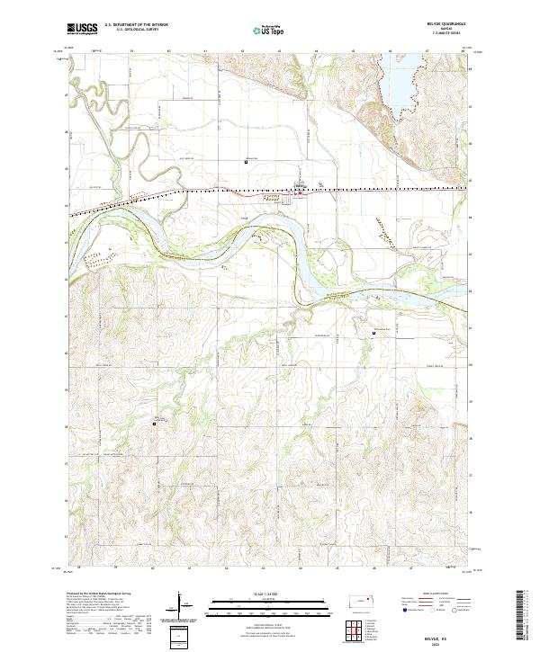
2022 Map of Belvue
USGS Topo · Published 2022About this map
The Kansas River winds through the heart of this landscape, forming the natural boundary between Pottawatomie and Wabaunsee counties. The settlement of Belvue sits just north of the river, defined by a grid of streets including 3rd St and Shortt Rd. This area reflects the deep history of westward movement, with Oregon Trail Rd skirting the northern hills and Old Post Rd running parallel to the modern highway corridor.
Find a feature on this map
55 named features on this map. Tap any name to fly to it.
Don’t see what you’re looking for? This feature index may not catch every label — zoom into the map to look around manually.
Map Details
Editions of this 2022 Belvue Map
This is the sole edition of this map. No revisions or reprints were ever made.
Other maps of this area

1889 · Wamego
USGS Topo · 1:125,000

1894 · Wamego
USGS Topo · 1:125,000

1953 · Wamego
USGS Topo · 1:24,000

1953 · Maple Hill
USGS Topo · 1:24,000

1953 · Belvue
USGS Topo · 1:24,000

1953 · St Marys
USGS Topo · 1:24,000

1954 · Alma
USGS Topo · 1:24,000

1954 · Mc Farland
USGS Topo · 1:24,000

1955 · Manhattan
USGS Topo · 1:250,000

1956 · Manhattan
USGS Topo · 1:250,000