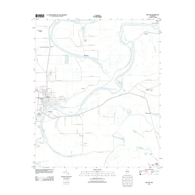
2012 Map of Belzoni
USGS Topo · Published 2012About this map
The Yazoo River defines the landscape of this Humphreys County region, winding through a complex system of sloughs, lakes, and drainage ditches characteristic of the Mississippi Delta. The city of Belzoni sits at the heart of this network, surrounded by a rural tapestry of smaller settlements like Brooklyn, Deovolente, and Famosla. The legacy of family and community is evident in the numerous cemeteries dotting the quadrangle, from Macedonia Cem in the north to Carson Cem in the southwest.
Find a feature on this map
81 named features on this map. Tap any name to fly to it.
Don’t see what you’re looking for? This feature index may not catch every label — zoom into the map to look around manually.
Map Details
Editions of this 2012 Belzoni Map
This is the sole edition of this map. No revisions or reprints were ever made.
Other maps of this area

1940 · Auter
USGS Topo · 1:62,500

1940 · Baird
USGS Topo · 1:62,500

1940 · Mileston
USGS Topo · 1:62,500

1953 · Greenwood
USGS Topo · 1:250,000

1954 · Mileston
USGS Topo · 1:62,500

1956 · Greenwood
USGS Topo · 1:250,000

1961 · Mossy Lake
USGS Topo · 1:62,500
1965 · Midnight
USGS Topo · 1:24,000

1965 · Inverness
USGS Topo · 1:24,000
1965 · Bellewood
USGS Topo · 1:24,000