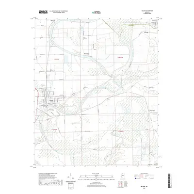
2020 Map of Belzoni
USGS Topo · Published 2020About this map
The Humphreys County Courthouse serves as the focal point of Belzoni, positioned near a sweeping bend of the Yazoo River. This section of the Mississippi Delta is defined by an intricate network of waterways and oxbow remnants, including Blue Hole, Gunn Bayou, and the expansive Lake Discovery. The landscape is dotted with rural settlements such as Jaketown, Deovolente, and Famosla, reflecting a distribution of community life across the fertile alluvial plain.
Find a feature on this map
97 named features on this map. Tap any name to fly to it.
Don’t see what you’re looking for? This feature index may not catch every label — zoom into the map to look around manually.
Map Details
Editions of this 2020 Belzoni Map
This is the sole edition of this map. No revisions or reprints were ever made.
Other maps of this area

1940 · Auter
USGS Topo · 1:62,500

1940 · Baird
USGS Topo · 1:62,500

1940 · Mileston
USGS Topo · 1:62,500

1953 · Greenwood
USGS Topo · 1:250,000

1954 · Mileston
USGS Topo · 1:62,500

1956 · Greenwood
USGS Topo · 1:250,000

1961 · Mossy Lake
USGS Topo · 1:62,500
1965 · Midnight
USGS Topo · 1:24,000

1965 · Inverness
USGS Topo · 1:24,000
1965 · Bellewood
USGS Topo · 1:24,000