2024 Map of Belzoni
USGS Topo · Published 2024About this map
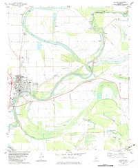
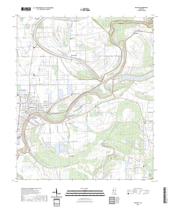
Belzoni serves as the focal point of this Humphreys County landscape, situated where the Yazoo River begins its winding course through a complex network of bayous and brakes. The town's grid, anchored by the Humphreys County Courthouse, transitions into a delta terrain defined by seasonal water patterns and agricultural drainage like Ditch Number Twenty One. Smaller settlements such as Brooklyn, Jaketown, and Deovolente are linked by rural roads that trace the natural levees of Bear Creek and Fisk Bayou. For genealogists, the map is particularly detailed, locating several burial grounds including Deovolente Cem, Woodland Cem, and Macedonia Cem. The eastern portion of the sheet reveals the river's geomorphology through features like Pelican Bend, the Famosla Cut-Off, and the marshy expanses of Mathena Brake and Toney Brake, illustrating the persistent influence of the river on local settlement patterns.
Find a feature on this map
86 named features on this map. Tap any name to fly to it.
Don’t see what you’re looking for? This feature index may not catch every label — zoom into the map to look around manually.
Map Details
Editions of this 2024 Belzoni Map
This is the sole edition of this map. No revisions or reprints were ever made.