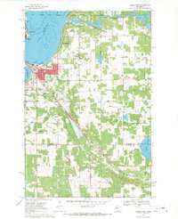
1968 Map of Bemidji East
USGS Topo · Published 1971About this map
Bemidji sits at the northern turn of the Mississippi River, where the legendary waterway flows through Lake Bemidji and connects to Lake Irving in the west. This late 1960s survey documents a bustling regional center, showing the concentrated development around Bemidji State College and the specialized infrastructure of the Midway Seaplane Base. Transportation corridors define the city's structure, with the Great Northern and Northern Pacific railroads converging south of the central business district near Vocational Sch.
Find a feature on this map
36 named features on this map. Tap any name to fly to it.
Don’t see what you’re looking for? This feature index may not catch every label — zoom into the map to look around manually.
Map Details
Editions of this 1968 Bemidji East Map
3 editions found
Other maps of this area

1920 · Buena Vista
USGS Topo · 1:62,500

1954 · Bemidji
USGS Topo · 1:250,000

1957 · Bemidji
USGS Topo · 1:250,000

1958 · Bemidji
USGS Topo · 1:250,000

1968 · Guthrie
USGS Topo · 1:24,000

1968 · Bemidji East
USGS Topo · 1:24,000

1968 · Frontenac Lake
USGS Topo · 1:24,000

1968 · Bemidji West
USGS Topo · 1:24,000

1972 · Peterson Lake
USGS Topo · 1:24,000

1972 · Turtle River Lake
USGS Topo · 1:24,000