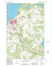
1968 Map of Bemidji East
USGS Topo · Published 1995About this map
The Mississippi River winds through this northern landscape, connecting Lake Bemidji and Lake Irving at the heart of the region's development. In the late 1960s, the city of Bemidji serves as a significant hub of education and transit, anchored by the Bemidji State College campus and various specialized institutions like the Vocational School. The map illustrates a community shaped by its proximity to water and woods, from the Midway Seaplane Base on the shoreline to the nearby Buena Vista State Forest and Lake Bemidji State Park.
Find a feature on this map
37 named features on this map. Tap any name to fly to it.
Don’t see what you’re looking for? This feature index may not catch every label — zoom into the map to look around manually.
Map Details
Editions of this 1968 Bemidji East Map
3 editions found
Other maps of this area

1920 · Buena Vista
USGS Topo · 1:62,500

1954 · Bemidji
USGS Topo · 1:250,000

1957 · Bemidji
USGS Topo · 1:250,000

1958 · Bemidji
USGS Topo · 1:250,000

1968 · Guthrie
USGS Topo · 1:24,000

1968 · Bemidji East
USGS Topo · 1:24,000

1968 · Frontenac Lake
USGS Topo · 1:24,000

1968 · Bemidji West
USGS Topo · 1:24,000

1972 · Peterson Lake
USGS Topo · 1:24,000

1972 · Turtle River Lake
USGS Topo · 1:24,000