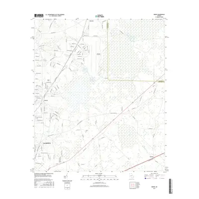
2017 Map of Bemiss
USGS Topo · Published 2017About this map
Moody Air Force Base dominates the central geography of this 2017 survey, surrounded by a landscape where military infrastructure meets the wetlands of the Georgia coastal plain. To the south, the northern reaches of Valdosta begin to transition into rural communities like Bemiss and Delmar. The map illustrates a distinctive pattern of drainage and water storage, with the vast Grand Bay and Grand Bay Creek system threading through the eastern half of the quadrangle. Local history is preserved through sites such as Antioch Cem and Hightower Cem, which sit alongside established routes like Cat Creek Rd and Knights Academy Rd. The presence of small settlements like Barretts and the aviation-focused Mallory Field further highlights the mix of agricultural heritage and modern strategic operations in Lowndes County.
Find a feature on this map
132 named features on this map. Tap any name to fly to it.
Don’t see what you’re looking for? This feature index may not catch every label — zoom into the map to look around manually.
Map Details
Editions of this 2017 Bemiss Map
This is the sole edition of this map. No revisions or reprints were ever made.
Other maps of this area

1953 · Waycross
USGS Topo · 1:250,000

1954 · Valdosta
USGS Topo · 1:250,000

1958 · Valdosta
USGS Topo · 1:250,000

1958 · Waycross
USGS Topo · 1:250,000

1959 · Valdosta
USGS Topo · 1:250,000

1961 · Hahira East
USGS Topo · 1:24,000

1961 · Valdosta
USGS Topo · 1:24,000

1968 · Naylor
USGS Topo · 1:24,000

1968 · Lakeland
USGS Topo · 1:24,000

1971 · Indianola
USGS Topo · 1:24,000