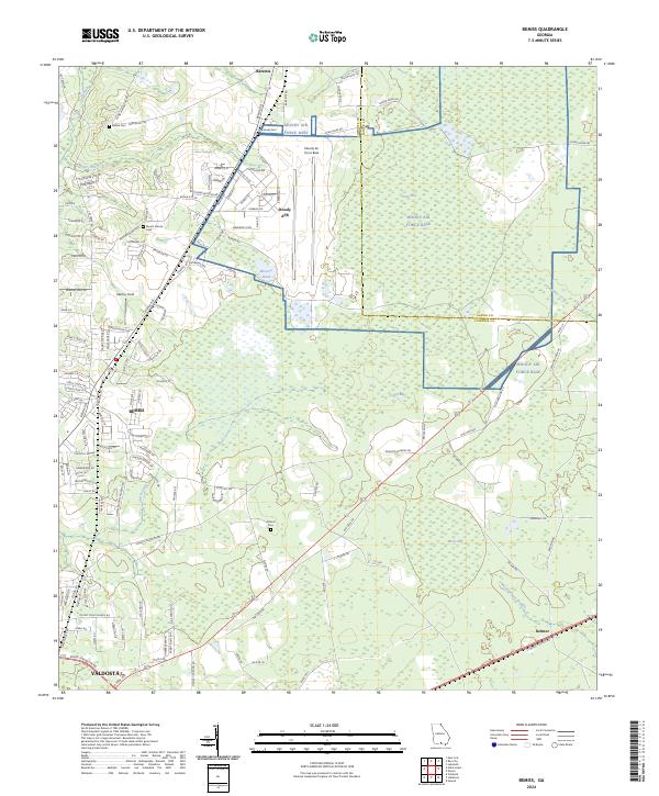
2024 Map of Bemiss
USGS Topo · Published 2024About this map
Moody Air Force Base dominates the northeastern landscape of this quadrangle, its runways and infrastructure bordering the expansive wetlands of Grand Bay and Peters Bay. The map captures the interface between military operations and the rural communities of Lowndes and Lanier Counties, centered around the settlement of Bemiss. This area is characterized by a dense network of local roads such as Radar Site Rd and Vienna Church Rd, which serve small residential pockets and agricultural plots.
Find a feature on this map
140 named features on this map. Tap any name to fly to it.
Don’t see what you’re looking for? This feature index may not catch every label — zoom into the map to look around manually.
Map Details
Editions of this 2024 Bemiss Map
This is the sole edition of this map. No revisions or reprints were ever made.
Other maps of this area

1953 · Waycross
USGS Topo · 1:250,000

1954 · Valdosta
USGS Topo · 1:250,000

1958 · Valdosta
USGS Topo · 1:250,000

1958 · Waycross
USGS Topo · 1:250,000

1959 · Valdosta
USGS Topo · 1:250,000

1961 · Hahira East
USGS Topo · 1:24,000

1961 · Valdosta
USGS Topo · 1:24,000

1968 · Naylor
USGS Topo · 1:24,000

1968 · Lakeland
USGS Topo · 1:24,000

1971 · Indianola
USGS Topo · 1:24,000