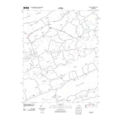
2010 Map of Ben Hur
USGS Topo · Published 2010About this map
Stone Mountain and Stone Ridge frame this southwest Virginia landscape, where the Powell River winds through a valley defined by deep-rooted family history and rural industry. The presence of Collier Mill and Kincer Mill points to a legacy of water-powered agriculture along the area's many branches and creeks. Dozens of family burial grounds, such as Wampler Cemetery, Daugherty Cemetery, and Miller Chapel Cemetery, are scattered across the ridges, providing a dense record for genealogical research in Lee County.
Find a feature on this map
71 named features on this map. Tap any name to fly to it.
Don’t see what you’re looking for? This feature index may not catch every label — zoom into the map to look around manually.
Map Details
Editions of this 2010 Ben Hur Map
This is the sole edition of this map. No revisions or reprints were ever made.
Other maps of this area

1887 · Jonesville
USGS Topo · 1:125,000

1891 · Jonesville
USGS Topo · 1:125,000

1894 · Estillville
USGS Topo · 1:125,000

1916 · Nolansburg
USGS Topo · 1:48,000

1919 · Nolansburg
USGS Topo · 1:62,500

1921 · Big Stone Gap
USGS Topo · 1:48,000

1922 · Big Stone Gap
USGS Topo · 1:62,500

1929 · Big Stone Gap
USGS Topo · 1:62,500

1935 · Kyles Ford
USGS Topo · 1:24,000

1935 · Looneys Gap
USGS Topo · 1:24,000