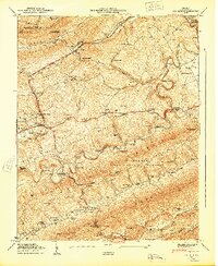
1949 Map of Ben Hur
USGS Topo · Published 1949About this map
Jonesville and the nearby village of Ben Hur serve as the primary hubs in this late 1940s landscape, where the Louisville and Nashville railroad winds through the terrain of Poor Valley Ridge. The map documents a rural economy still heavily tied to its waterways and local industries, featuring Collier Mill and Kincer Mill, alongside numerous family burial grounds such as Wampler Cem and Daugherty Cem.
Find a feature on this map
90 named features on this map. Tap any name to fly to it.
Don’t see what you’re looking for? This feature index may not catch every label — zoom into the map to look around manually.
Map Details
Editions of this 1949 Ben Hur Map
This is the sole edition of this map. No revisions or reprints were ever made.
Other maps of this area

1887 · Jonesville
USGS Topo · 1:125,000

1891 · Jonesville
USGS Topo · 1:125,000

1894 · Estillville
USGS Topo · 1:125,000

1916 · Nolansburg
USGS Topo · 1:48,000

1919 · Nolansburg
USGS Topo · 1:62,500

1921 · Big Stone Gap
USGS Topo · 1:48,000

1922 · Big Stone Gap
USGS Topo · 1:62,500

1929 · Big Stone Gap
USGS Topo · 1:62,500

1935 · Kyles Ford
USGS Topo · 1:24,000

1935 · Looneys Gap
USGS Topo · 1:24,000