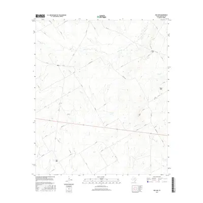
2016 Map of Ben Hur
USGS Topo · Published 2016About this map
The settlement of Ben Hur anchors the southwestern corner of this Limestone County landscape, where a dense network of county roads connects rural communities and agricultural holdings. The terrain is defined by a series of drainages, including the branching reaches of Christmas Cr in the north and Big Elm Cr and Elm Cr through the center. In the east, the distinct topography of Horn Hill rises above the surrounding area, accompanied by the Horn Hill Cem. Further north, the small centers of Kirk and Honest Ridge sit at local road junctions, reflecting the enduring rural settlement patterns of central Texas. Genealogy researchers will find interest in localized sites like Nus Cem, situated near FM 339, providing specific points of reference for family histories in this part of the county.
Find a feature on this map
52 named features on this map. Tap any name to fly to it.
Don’t see what you’re looking for? This feature index may not catch every label — zoom into the map to look around manually.
Map Details
Editions of this 2016 Ben Hur Map
This is the sole edition of this map. No revisions or reprints were ever made.
Other maps of this area

1920 · Mart
USGS Topo · 1:62,500

1954 · Waco
USGS Topo · 1:250,000

1955 · Waco
USGS Topo · 1:250,000

1956 · Mart
USGS Topo · 1:24,000

1957 · Prairie Hill
USGS Topo · 1:24,000

1957 · Groesbeck
USGS Topo · 1:62,500

1957 · Otto
USGS Topo · 1:24,000

1960 · Echols
USGS Topo · 1:24,000

1960 · Groesbeck
USGS Topo · 1:24,000

1960 · Tehuacana
USGS Topo · 1:24,000