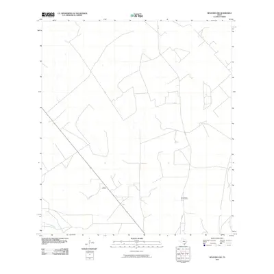
2010 Map of Benavides NW
USGS Topo · Published 2010About this map
Guerra Cemetery stands as a primary landmark in this rural landscape of Duval County, reflecting the deep-rooted family ties and cultural history of South Texas. This 2010 survey illustrates a region defined by large rangelands and a geometric network of local routes, including Co Rd 314 and Co Rd 340, which facilitate movement between scattered ranching interests and local landmarks. The southern portion of the area is drained by Las Animas Creek, a seasonal waterway that shapes the low-lying terrain.
Find a feature on this map
6 named features on this map. Tap any name to fly to it.
Don’t see what you’re looking for? This feature index may not catch every label — zoom into the map to look around manually.
Map Details
Editions of this 2010 Benavides NW Map
This is the sole edition of this map. No revisions or reprints were ever made.
Other maps of this area

1956 · Benavides
USGS Topo · 1:62,500

1956 · Rosita Ranch
USGS Topo · 1:62,500

1956 · Freer
USGS Topo · 1:62,500

1956 · Laredo
USGS Topo · 1:250,000

1967 · Parrilla Creek SE
USGS Topo · 1:24,000

1968 · Benavides NW
USGS Topo · 1:24,000

1968 · San Jose
USGS Topo · 1:24,000

1968 · Benavides
USGS Topo · 1:24,000

1968 · Parrilla Creek NE
USGS Topo · 1:24,000
1968 · Benavides NE
USGS Topo · 1:24,000