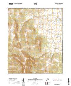
2017 Map of Bendeleben A-1 NE
USGS Topo · Published 2017About this map
Seward Peninsula terrain dominates this 2017 study of the Bendeleben A-1 NE quadrangle, defined by a network of drainage systems flowing through the interior. Waterways like Butte Cr and Copper Cr carve through the northern sections, while Moonlight Cr and June Cr drain the southern reaches. The map highlights the systematic division of the land through township and range boundaries, including t3s r17w and t4s r16w. This survey provides a modern snapshot of the region's topographical character, showing the distribution of elevation and hydrology in an area devoid of roads or major settlements, emphasizing the fundamental natural features of this remote Alaskan landscape.
Find a feature on this map
9 named features on this map. Tap any name to fly to it.
Don’t see what you’re looking for? This feature index may not catch every label — zoom into the map to look around manually.
Map Details
Editions of this 2017 Bendeleben A-1 NE Map
This is the sole edition of this map. No revisions or reprints were ever made.
Other maps of this area

1950 · Bendeleben B-1
USGS Topo · 1:63,360

1950 · Bendeleben A-1
USGS Topo · 1:63,360

1950 · Bendeleben
USGS Topo · 1:250,000

1950 · Candle A-6
USGS Topo · 1:63,360

1950 · Candle B-6
USGS Topo · 1:63,360

1951 · Candle
USGS Topo · 1:250,000

1951 · Bendeleben
USGS Topo · 1:250,000

1955 · Candle
USGS Topo · 1:250,000

1964 · Bendeleben
USGS Topo · 1:250,000

1964 · Candle
USGS Topo · 1:250,000