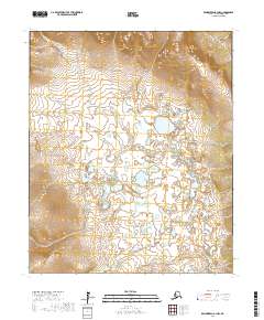
2017 Map of Bendeleben A-1 NW
USGS Topo · Published 2017About this map
The Tubutulik River meanders through this portion of the Seward Peninsula, cutting a complex path through a landscape defined by its remote drainage systems. The hydrography of the region is characterized by numerous small tributaries and seasonal flows, including Granite Cr and Haven Cr, which feed into the larger river basin.
Find a feature on this map
12 named features on this map. Tap any name to fly to it.
Don’t see what you’re looking for? This feature index may not catch every label — zoom into the map to look around manually.
Map Details
Editions of this 2017 Bendeleben A-1 NW Map
This is the sole edition of this map. No revisions or reprints were ever made.
Other maps of this area

1950 · Bendeleben B-2
USGS Topo · 1:63,360

1950 · Bendeleben B-1
USGS Topo · 1:63,360

1950 · Bendeleben A-2
USGS Topo · 1:63,360

1950 · Bendeleben A-1
USGS Topo · 1:63,360

1950 · Bendeleben
USGS Topo · 1:250,000

1951 · Bendeleben
USGS Topo · 1:250,000

1964 · Bendeleben
USGS Topo · 1:250,000
2017 · Bendeleben A-1 NE
USGS Topo · 1:25,000
2017 · Bendeleben B-1 SW
USGS Topo · 1:25,000
2017 · Bendeleben A-2 NE
USGS Topo · 1:25,000