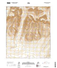
2017 Map of Bendeleben A-2 NW
USGS Topo · Published 2017About this map
The Bendeleben Mountains dominate this 2017 survey area on the Seward Peninsula, where high elevations like Mt Ost overlook a network of creek drainages. The landscape is characterized by its steep, contour-heavy terrain in the northern sections, which gives way to broader valleys in the south. These valleys are defined by the courses of Wagon Wheel Cr, Lava Cr, and Telephone Cr, each carving through the remote Alaskan interior.
Find a feature on this map
11 named features on this map. Tap any name to fly to it.
Don’t see what you’re looking for? This feature index may not catch every label — zoom into the map to look around manually.
Map Details
Editions of this 2017 Bendeleben A-2 NW Map
This is the sole edition of this map. No revisions or reprints were ever made.
Other maps of this area

1950 · Bendeleben B-2
USGS Topo · 1:63,360

1950 · Bendeleben A-3
USGS Topo · 1:63,360

1950 · Bendeleben A-2
USGS Topo · 1:63,360

1950 · Bendeleben B-3
USGS Topo · 1:63,360

1950 · Bendeleben
USGS Topo · 1:250,000

1951 · Bendeleben
USGS Topo · 1:250,000

1964 · Bendeleben
USGS Topo · 1:250,000
2017 · Bendeleben A-2 SW
USGS Topo · 1:25,000
2017 · Bendeleben A-2 NE
USGS Topo · 1:25,000
2017 · Bendeleben B-2 SW
USGS Topo · 1:25,000