
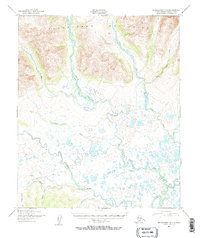
1950 Map of Bendeleben A-3
USGS Topo · Published 1955About this map
The Bendeleben Mountains dominate the northern horizon of this 1950s survey, their southern slopes descending into the expansive, water-soaked expanse of McCarthy Marsh. This landscape is defined by its complex drainage systems, where the Niukluk River, Fish River, and Pargon River converge and meander through the lowlands. The presence of both a Wagon Road and a Winter Trail highlights the seasonal nature of travel in the Seward Peninsula interior during the mid-century.
Find a feature on this map
17 named features on this map. Tap any name to fly to it.
Don’t see what you’re looking for? This feature index may not catch every label — zoom into the map to look around manually.
Map Details
Editions of this 1950 Bendeleben A-3 Map
2 editions found
Other maps of this area

1950 · Bendeleben A-4
USGS Topo · 1:63,360

1950 · Bendeleben B-2
USGS Topo · 1:63,360

1950 · Bendeleben B-4
USGS Topo · 1:63,360

1950 · Bendeleben A-2
USGS Topo · 1:63,360

1950 · Bendeleben B-3
USGS Topo · 1:63,360

1950 · Solomon D-2
USGS Topo · 1:63,360

1950 · Bendeleben
USGS Topo · 1:250,000

1950 · Solomon D-3
USGS Topo · 1:63,360

1950 · Solomon
USGS Topo · 1:250,000

1950 · Solomon D-4
USGS Topo · 1:63,360