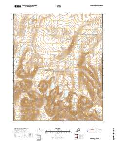
2017 Map of Bendeleben B-2 SW
USGS Topo · Published 2017About this map
Bering Land Bridge National Preserve occupies a central role in this portion of the Seward Peninsula, preserving a landscape that remains largely defined by its natural hydrology and high-elevation terrain. The Bendeleben Mountains rise prominently in the southern section of the quadrangle, where steep contour lines indicate a significant rise from the surrounding lowlands. This area is characterized by the headwaters of several drainages, including Wagon Wheel Cr and Lava Cr, which navigate the base of the mountain range. The absence of modern roads or settlements highlights the isolation of this region within the Nome Census Area, where the land is managed primarily for its ecological and historical significance as part of the ancient migration corridor between continents.
Find a feature on this map
11 named features on this map. Tap any name to fly to it.
Don’t see what you’re looking for? This feature index may not catch every label — zoom into the map to look around manually.
Map Details
Editions of this 2017 Bendeleben B-2 SW Map
This is the sole edition of this map. No revisions or reprints were ever made.
Other maps of this area

1950 · Bendeleben B-2
USGS Topo · 1:63,360

1950 · Bendeleben A-3
USGS Topo · 1:63,360

1950 · Bendeleben A-2
USGS Topo · 1:63,360

1950 · Bendeleben B-3
USGS Topo · 1:63,360

1950 · Bendeleben
USGS Topo · 1:250,000

1951 · Bendeleben
USGS Topo · 1:250,000

1964 · Bendeleben
USGS Topo · 1:250,000
2017 · Bendeleben A-2 NW
USGS Topo · 1:25,000
2017 · Bendeleben A-2 NE
USGS Topo · 1:25,000
2017 · Bendeleben B-2 NE
USGS Topo · 1:25,000