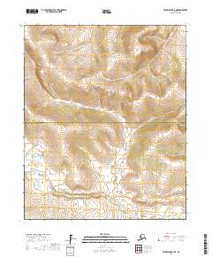
2017 Map of Bendeleben B-2 NE
USGS Topo · Published 2017About this map
The Koyuk River winds through the southern reaches of this landscape, marking a prominent hydrological feature near the border between the Northwest Arctic Borough and Nome Census Area. This subarctic terrain is defined by its drainages, including Knowles Cr, French Cr, and Spruce Cr, which flow across the township lines of T1N and T1S. The convergence of these borough and census boundaries highlights the intersection of administrative regions in this remote Alaskan interior, where the land is primarily characterized by the natural flow of its river systems rather than established road networks or settlements.
Find a feature on this map
9 named features on this map. Tap any name to fly to it.
Don’t see what you’re looking for? This feature index may not catch every label — zoom into the map to look around manually.
Map Details
Editions of this 2017 Bendeleben B-2 NE Map
This is the sole edition of this map. No revisions or reprints were ever made.
Other maps of this area

1950 · Bendeleben C-1
USGS Topo · 1:63,360

1950 · Bendeleben B-2
USGS Topo · 1:63,360

1950 · Bendeleben C-2
USGS Topo · 1:63,360

1950 · Bendeleben B-1
USGS Topo · 1:63,360

1950 · Bendeleben
USGS Topo · 1:250,000

1951 · Bendeleben
USGS Topo · 1:250,000

1964 · Bendeleben
USGS Topo · 1:250,000
2017 · Bendeleben C-2 SE
USGS Topo · 1:25,000
2017 · Bendeleben B-1 SW
USGS Topo · 1:25,000
2017 · Bendeleben C-2 SW
USGS Topo · 1:25,000