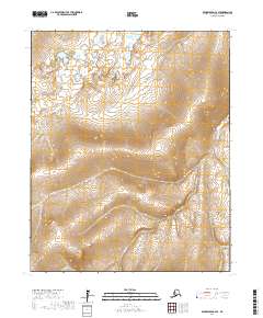
2017 Map of Bendeleben C-2 SE
USGS Topo · Published 2017About this map
Circle Creek and Spruce Creek define the drainage patterns across this section of the Northwest Arctic, where the landscape is etched by a series of north and south-flowing waterways. This 2017 topographic survey by the U.S. Geological Survey captures a sparsely labeled wilderness area where the Public Land Survey System grid intersects with natural topographical contours. The map reveals the intricate headwaters of several streams, including French Creek and Goose Creek, providing a foundational record of the terrain as it appeared in the early 21st century. The relative absence of human infrastructure highlights the preservation of the natural drainage network, including smaller tributaries like Pauline Creek and Holtz Creek that feed into the larger regional water systems.
Find a feature on this map
12 named features on this map. Tap any name to fly to it.
Don’t see what you’re looking for? This feature index may not catch every label — zoom into the map to look around manually.
Map Details
Editions of this 2017 Bendeleben C-2 SE Map
This is the sole edition of this map. No revisions or reprints were ever made.
Other maps of this area

1950 · Bendeleben C-1
USGS Topo · 1:63,360

1950 · Bendeleben B-2
USGS Topo · 1:63,360

1950 · Bendeleben C-2
USGS Topo · 1:63,360

1950 · Bendeleben B-1
USGS Topo · 1:63,360

1950 · Bendeleben
USGS Topo · 1:250,000

1951 · Bendeleben
USGS Topo · 1:250,000

1964 · Bendeleben
USGS Topo · 1:250,000
2017 · Bendeleben C-1 NW
USGS Topo · 1:25,000
2017 · Bendeleben B-2 NE
USGS Topo · 1:25,000
2017 · Bendeleben C-2 SW
USGS Topo · 1:25,000