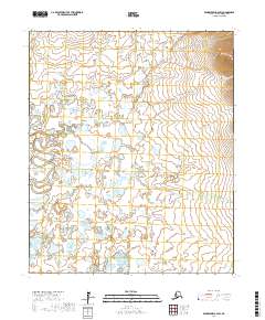
2017 Map of Bendeleben A-2 SW
USGS Topo · Published 2017About this map
Fish River winds through the southwestern corner of this sub-arctic landscape, serving as the primary drainage for an intricate network of waterways. In this remote stretch of the Bendeleben Mountains region, the hydrologic pattern reveals a terrain defined by meandering streams and seasonal flow, including Telephone Creek and Mosquito Creek. The map shows the land partitioned by the Public Land Survey System, with township and range lines such as t5s r21w crossing a landscape of numerous small lakes and ponds. Omilak Creek enters from the southern reaches, highlighting the drainage complexity of this tundra environment in the early twenty-first century.
Find a feature on this map
11 named features on this map. Tap any name to fly to it.
Don’t see what you’re looking for? This feature index may not catch every label — zoom into the map to look around manually.
Map Details
Editions of this 2017 Bendeleben A-2 SW Map
This is the sole edition of this map. No revisions or reprints were ever made.
Other maps of this area

1950 · Bendeleben A-3
USGS Topo · 1:63,360

1950 · Bendeleben A-2
USGS Topo · 1:63,360

1950 · Solomon D-2
USGS Topo · 1:63,360

1950 · Bendeleben
USGS Topo · 1:250,000

1950 · Solomon D-3
USGS Topo · 1:63,360

1950 · Solomon
USGS Topo · 1:250,000

1951 · Bendeleben
USGS Topo · 1:250,000

1951 · Solomon
USGS Topo · 1:250,000

1964 · Bendeleben
USGS Topo · 1:250,000
2014 · Solomon D-2 NE
USGS Topo · 1:25,000