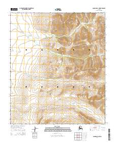
2014 Map of Solomon D-2 NE
USGS Topo · Published 2014About this map
The Darby Mountains dominate the eastern landscape of this 2014 survey on the Seward Peninsula. This terrain is defined by steep elevation changes and the headwaters of vital regional waterways, particularly the northward-flowing Omilak Cr. The presence of these creeks suggests the intricate drainage patterns characteristic of the Alaskan interior, where seasonal runoff from the higher peaks feeds the low-lying basins. To the south, Dry Canyon Cr cuts through the ridges, illustrating the natural corridors that have historically influenced movement and drainage in this remote Seward Peninsula interior. The map illustrates a landscape primarily defined by its physical geography, with no permanent settlements or structures indicated within the township boundaries.
Find a feature on this map
7 named features on this map. Tap any name to fly to it.
Don’t see what you’re looking for? This feature index may not catch every label — zoom into the map to look around manually.
Map Details
Editions of this 2014 Solomon D-2 NE Map
This is the sole edition of this map. No revisions or reprints were ever made.
Other maps of this area

1950 · Bendeleben A-2
USGS Topo · 1:63,360

1950 · Bendeleben A-1
USGS Topo · 1:63,360

1950 · Solomon D-2
USGS Topo · 1:63,360

1950 · Bendeleben
USGS Topo · 1:250,000

1950 · Solomon D-1
USGS Topo · 1:63,360

1950 · Solomon
USGS Topo · 1:250,000

1951 · Bendeleben
USGS Topo · 1:250,000

1951 · Solomon
USGS Topo · 1:250,000

1964 · Bendeleben
USGS Topo · 1:250,000
2014 · Solomon D-2 SE
USGS Topo · 1:25,000