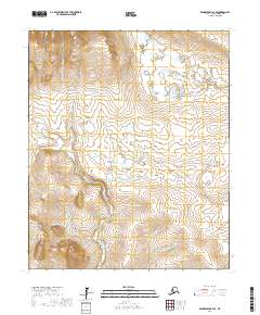
2017 Map of Bendeleben A-4 SE
USGS Topo · Published 2017About this map
The Seward Peninsula interior is defined by a dense network of watercourses in this modern survey, highlighting a landscape shaped by drainage and mineral prospects. The convergence of numerous creeks, such as Ophir Cr, Utica Cr, and Crooked Cr, suggests a complex hydrologic system feeding into the Pargon River in the northeast. This area of the Bendeleben Mountains is characterized by evocative naming conventions, with Balm of Gilead Gulch and Snowball Cr providing distinct markers for navigation in an otherwise open terrain. Many of these waterways, including Bullion Cr and Gold Cr, bear names synonymous with the region's prospecting history, reflecting the search for resources that drove movement across the peninsula. The map provides precise topographic detail for those studying the physical geography or the legacy of mining claims in the Nome Census Area.
Find a feature on this map
24 named features on this map. Tap any name to fly to it.
Don’t see what you’re looking for? This feature index may not catch every label — zoom into the map to look around manually.
Map Details
Editions of this 2017 Bendeleben A-4 SE Map
This is the sole edition of this map. No revisions or reprints were ever made.
Other maps of this area

1950 · Bendeleben A-4
USGS Topo · 1:63,360

1950 · Bendeleben A-3
USGS Topo · 1:63,360

1950 · Bendeleben
USGS Topo · 1:250,000

1950 · Solomon D-3
USGS Topo · 1:63,360

1950 · Solomon
USGS Topo · 1:250,000

1950 · Solomon D-4
USGS Topo · 1:63,360

1951 · Bendeleben
USGS Topo · 1:250,000

1951 · Solomon
USGS Topo · 1:250,000

1964 · Bendeleben
USGS Topo · 1:250,000

1970 · Bendeleben A-4
USGS Topo · 1:63,360