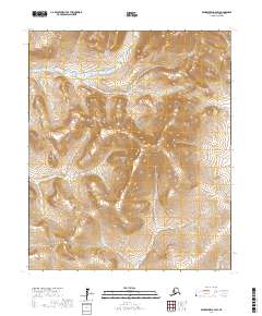
2017 Map of Bendeleben A-4 SW
USGS Topo · Published 2017About this map
The Seward Peninsula interior is defined by a dense network of watercourses and elevation changes in this Bendeleben A-4 SW quadrangle. Significant drainages like Kingsley Cr and Nesbit Cr flow through the northern reaches, while Goldbottom Cr and Virginia Cr cut through the southern terrain. A notable break in the upland topography appears at Grass Valley, providing a distinct geographic landmark amidst the surrounding slopes.
Find a feature on this map
18 named features on this map. Tap any name to fly to it.
Don’t see what you’re looking for? This feature index may not catch every label — zoom into the map to look around manually.
Map Details
Editions of this 2017 Bendeleben A-4 SW Map
This is the sole edition of this map. No revisions or reprints were ever made.
Other maps of this area

1907 · Casadepaga
USGS Topo · 1:62,500

1950 · Bendeleben A-4
USGS Topo · 1:63,360

1950 · Bendeleben A-5
USGS Topo · 1:63,360

1950 · Bendeleben
USGS Topo · 1:250,000

1950 · Solomon
USGS Topo · 1:250,000

1950 · Solomon D-4
USGS Topo · 1:63,360

1950 · Solomon D-5
USGS Topo · 1:63,360

1951 · Bendeleben
USGS Topo · 1:250,000

1951 · Solomon
USGS Topo · 1:250,000

1964 · Bendeleben
USGS Topo · 1:250,000