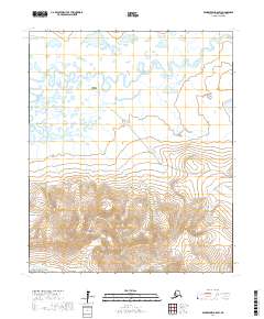
2017 Map of Bendeleben A-6 SW
USGS Topo · Published 2017About this map
Pilgrim Springs serves as the focal point of this remote Alaskan landscape, situated where the meandering Pilgrim River flows through the northern reaches of the Seward Peninsula. The terrain is defined by the dramatic ascent of the Kigluaik Mountains in the south, which rise sharply from the river valley. The Pilgrim Hot Springs Road provides the primary overland connection through this area, crossing several small waterways including Paustreak Cr. High-elevation drainages like Golden Gate Cr, Crater Cr, and Big Cr carve through the mountain slopes, illustrating the complex hydrography of this subarctic environment during the early 21st century.
Find a feature on this map
15 named features on this map. Tap any name to fly to it.
Don’t see what you’re looking for? This feature index may not catch every label — zoom into the map to look around manually.
Map Details
Editions of this 2017 Bendeleben A-6 SW Map
This is the sole edition of this map. No revisions or reprints were ever made.
Other maps of this area

1950 · Bendeleben A-6
USGS Topo · 1:63,360

1950 · Nome
USGS Topo · 1:250,000

1950 · Teller
USGS Topo · 1:250,000

1950 · Bendeleben
USGS Topo · 1:250,000

1950 · Solomon
USGS Topo · 1:250,000

1950 · Solomon D-6
USGS Topo · 1:63,360

1950 · Nome D-1
USGS Topo · 1:63,360

1950 · Teller A-1
USGS Topo · 1:63,360

1951 · Bendeleben
USGS Topo · 1:250,000

1951 · Nome
USGS Topo · 1:250,000