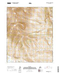
2017 Map of Bendeleben B-1 NE
USGS Topo · Published 2017About this map
The Continental Divide crests through the northeastern corner of this remote Alaskan terrain, where the headwaters of the Seward Peninsula begin their descent toward distinct drainages. The landscape is defined by the high elevations of Kiwalik Mtn in the north, providing a stark topographical contrast to the stream valleys below. This 2017 survey by the U.S. Geological Survey details the jurisdictional boundary between the Northwest Arctic Borough and the Nome Census Area, which bisects the quadrangle horizontally. The drainage patterns of First Chance Cr and Big Bar Cr offer a precise view of the hydrological divide that shapes this portion of the Alaskan interior.
Find a feature on this map
9 named features on this map. Tap any name to fly to it.
Don’t see what you’re looking for? This feature index may not catch every label — zoom into the map to look around manually.
Map Details
Editions of this 2017 Bendeleben B-1 NE Map
This is the sole edition of this map. No revisions or reprints were ever made.
Other maps of this area

1950 · Bendeleben C-1
USGS Topo · 1:63,360

1950 · Bendeleben B-1
USGS Topo · 1:63,360

1950 · Bendeleben
USGS Topo · 1:250,000

1950 · Candle B-6
USGS Topo · 1:63,360

1950 · Candle C-6
USGS Topo · 1:63,360

1951 · Candle
USGS Topo · 1:250,000

1951 · Bendeleben
USGS Topo · 1:250,000

1955 · Candle
USGS Topo · 1:250,000

1964 · Bendeleben
USGS Topo · 1:250,000

1964 · Candle
USGS Topo · 1:250,000