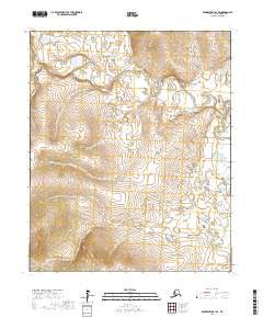
2017 Map of Bendeleben B-1 SE
USGS Topo · Published 2017About this map
The Koyuk River meanders across this portion of the Seward Peninsula, defining a landscape of complex waterways and wetlands. In this interior region, the river's path is joined by northern tributaries like Big Bar Cr and southern inflows such as Timber Cr. The drainage patterns shown here illustrate the delicate hydraulic systems of the Alaskan tundra, where small changes in elevation dictate the flow of glacial-fed streams. Surveyed as part of the National Geospatial Program, the map provides a high-resolution view of the township and range divisions, including t1s r17w and t2s r16w, which serve as the primary geographical markers in this roadless wilderness.
Find a feature on this map
10 named features on this map. Tap any name to fly to it.
Don’t see what you’re looking for? This feature index may not catch every label — zoom into the map to look around manually.
Map Details
Editions of this 2017 Bendeleben B-1 SE Map
This is the sole edition of this map. No revisions or reprints were ever made.
Other maps of this area

1950 · Bendeleben B-1
USGS Topo · 1:63,360

1950 · Bendeleben A-1
USGS Topo · 1:63,360

1950 · Bendeleben
USGS Topo · 1:250,000

1950 · Candle A-6
USGS Topo · 1:63,360

1950 · Candle B-6
USGS Topo · 1:63,360

1951 · Candle
USGS Topo · 1:250,000

1951 · Bendeleben
USGS Topo · 1:250,000

1955 · Candle
USGS Topo · 1:250,000

1964 · Bendeleben
USGS Topo · 1:250,000

1964 · Candle
USGS Topo · 1:250,000