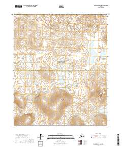
2017 Map of Bendeleben B-3 NW
USGS Topo · Published 2017About this map
The Bering Land Bridge National Preserve encompasses a significant portion of this interior landscape on the Seward Peninsula, where volcanic activity has left a distinct mark on the terrain. The presence of features such as Lost Jim Cone, Gosling Cone, and the Twin Calderas highlights the region's geological history. These volcanic formations rise above a network of tundra wetlands and lakes, including Joan Lake and Erich Lake.
Find a feature on this map
17 named features on this map. Tap any name to fly to it.
Don’t see what you’re looking for? This feature index may not catch every label — zoom into the map to look around manually.
Map Details
Editions of this 2017 Bendeleben B-3 NW Map
This is the sole edition of this map. No revisions or reprints were ever made.
Other maps of this area

1950 · Bendeleben C-3
USGS Topo · 1:63,360

1950 · Bendeleben B-4
USGS Topo · 1:63,360

1950 · Bendeleben C-4
USGS Topo · 1:63,360

1950 · Bendeleben B-3
USGS Topo · 1:63,360

1950 · Bendeleben
USGS Topo · 1:250,000

1951 · Bendeleben
USGS Topo · 1:250,000

1964 · Bendeleben
USGS Topo · 1:250,000
2017 · Bendeleben C-3 SW
USGS Topo · 1:25,000
2017 · Bendeleben B-4 NE
USGS Topo · 1:25,000
2017 · Bendeleben C-3 SE
USGS Topo · 1:25,000