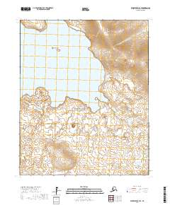
2017 Map of Bendeleben C-3 SE
USGS Topo · Published 2017About this map
Bering Land Bridge National Preserve encompasses much of this landscape on the Seward Peninsula, a region defined by its volcanic geology and extensive water bodies. The presence of Imuruk Lake, the largest lake on the peninsula, dominates the western half of the map, dotted with the small Gull Islands. The terrain is characterized by distinctive volcanic features such as Rhododendron Cone and Kettle Dome, which rise above the surrounding tundra. To the north, the coastline of Granite Bay and the drainage of the Kugruk River illustrate the transition from the high interior peaks to the coastal lowlands. This area remains largely undeveloped, preserving a wilderness that holds significant archeological importance for understanding the ancient migration routes between Asia and North America.
Find a feature on this map
15 named features on this map. Tap any name to fly to it.
Don’t see what you’re looking for? This feature index may not catch every label — zoom into the map to look around manually.
Map Details
Editions of this 2017 Bendeleben C-3 SE Map
This is the sole edition of this map. No revisions or reprints were ever made.
Other maps of this area

1950 · Bendeleben C-3
USGS Topo · 1:63,360

1950 · Bendeleben B-2
USGS Topo · 1:63,360

1950 · Bendeleben C-2
USGS Topo · 1:63,360

1950 · Bendeleben B-3
USGS Topo · 1:63,360

1950 · Bendeleben
USGS Topo · 1:250,000

1951 · Bendeleben
USGS Topo · 1:250,000

1964 · Bendeleben
USGS Topo · 1:250,000
2017 · Bendeleben C-2 SW
USGS Topo · 1:25,000
2017 · Bendeleben C-2 NW
USGS Topo · 1:25,000
2017 · Bendeleben B-2 NW
USGS Topo · 1:25,000