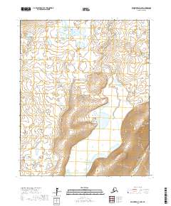
2017 Map of Bendeleben C-2 NW
USGS Topo · Published 2017About this map
Bering Land Bridge National Preserve occupies a significant portion of this high-latitude terrain on the Seward Peninsula. The landscape is defined by its complex drainage patterns and numerous small tundra ponds, primarily feeding into the Burnt River in the northwest and the Kugruk River in the southeast. While devoid of permanent settlements or modern roads, the map illustrates the underlying township and range structure used for land management in this arctic region, including divisions like t4n r20w and t3n r21w. The contour intervals reveal a relatively flat lowland characterized by wetlands and shifting watercourses, offering a detailed view of the peninsula's interior before it meets the Chukchi Sea.
Find a feature on this map
8 named features on this map. Tap any name to fly to it.
Don’t see what you’re looking for? This feature index may not catch every label — zoom into the map to look around manually.
Map Details
Editions of this 2017 Bendeleben C-2 NW Map
This is the sole edition of this map. No revisions or reprints were ever made.
Other maps of this area

1950 · Bendeleben C-3
USGS Topo · 1:63,360

1950 · Bendeleben C-2
USGS Topo · 1:63,360

1950 · Bendeleben D-2
USGS Topo · 1:63,360

1950 · Bendeleben
USGS Topo · 1:250,000

1950 · Bendeleben D-3
USGS Topo · 1:63,360

1951 · Bendeleben
USGS Topo · 1:250,000

1964 · Bendeleben
USGS Topo · 1:250,000
2017 · Bendeleben C-2 SE
USGS Topo · 1:25,000
2017 · Bendeleben D-2 SE
USGS Topo · 1:25,000
2017 · Bendeleben C-2 SW
USGS Topo · 1:25,000