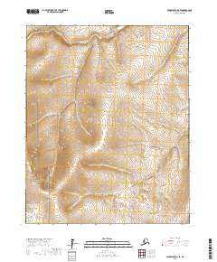
2017 Map of Bendeleben D-2 SE
USGS Topo · Published 2017About this map
Bering Land Bridge National Preserve encompasses the southwestern portion of this Alaskan landscape, where the terrain transitions from high ridges down toward the drainages of the Burnt River and Goldbug Cr. This 2017 study illustrates the intricate topography of the Seward Peninsula’s interior, characterized by its complex contour patterns and lack of established road infrastructure. The map serves as a primary record of the hydrological network within the Northwest Arctic Borough, tracing the headwaters and seasonal flows that define this protected wilderness. For those studying the geography of the preserve, the document provides precise alignment for the Public Land Survey System grids, including t5n r19w and t6n r19w, which underpin the region's administrative boundaries.
Find a feature on this map
9 named features on this map. Tap any name to fly to it.
Don’t see what you’re looking for? This feature index may not catch every label — zoom into the map to look around manually.
Map Details
Editions of this 2017 Bendeleben D-2 SE Map
This is the sole edition of this map. No revisions or reprints were ever made.
Other maps of this area

1950 · Bendeleben C-1
USGS Topo · 1:63,360

1950 · Bendeleben C-2
USGS Topo · 1:63,360

1950 · Bendeleben D-2
USGS Topo · 1:63,360

1950 · Bendeleben
USGS Topo · 1:250,000

1950 · Bendeleben D-1
USGS Topo · 1:63,360

1951 · Bendeleben
USGS Topo · 1:250,000

1964 · Bendeleben
USGS Topo · 1:250,000
2017 · Bendeleben D-2 NW
USGS Topo · 1:25,000
2017 · Bendeleben D-2 NE
USGS Topo · 1:25,000
2017 · Bendeleben C-1 NW
USGS Topo · 1:25,000