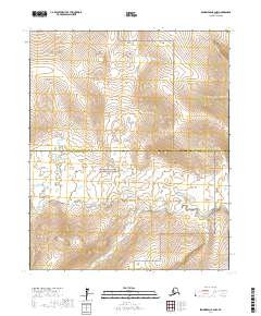
2017 Map of Bendeleben B-2 NW
USGS Topo · Published 2017About this map
The Continental Divide traverses the northern heights of this Seward Peninsula landscape, marking a significant hydrologic boundary in a region defined by its arctic wilderness. In the southern half of the quadrangle, the Bering Land Bridge National Preserve protects a vast stretch of tundra where the Koyuk River winds through the lowlands. This watercourse is fed by numerous tributaries including Olivine Creek, Betula Creek, and Salix Creek, which drain the surrounding uplands. The map documents the boundary between the Northwest Arctic Borough and the Nome Census Area, reflecting the modern administrative divisions of this sparsely populated territory. The absence of roads or permanent settlements underscores the remote nature of this environment, where the natural drainage patterns of Knowles Creek and its neighbors remain the primary geographical features.
Find a feature on this map
13 named features on this map. Tap any name to fly to it.
Don’t see what you’re looking for? This feature index may not catch every label — zoom into the map to look around manually.
Map Details
Editions of this 2017 Bendeleben B-2 NW Map
This is the sole edition of this map. No revisions or reprints were ever made.
Other maps of this area

1950 · Bendeleben C-3
USGS Topo · 1:63,360

1950 · Bendeleben B-2
USGS Topo · 1:63,360

1950 · Bendeleben C-2
USGS Topo · 1:63,360

1950 · Bendeleben B-3
USGS Topo · 1:63,360

1950 · Bendeleben
USGS Topo · 1:250,000

1951 · Bendeleben
USGS Topo · 1:250,000

1964 · Bendeleben
USGS Topo · 1:250,000
2017 · Bendeleben C-2 SE
USGS Topo · 1:25,000
2017 · Bendeleben B-2 NE
USGS Topo · 1:25,000
2017 · Bendeleben C-2 SW
USGS Topo · 1:25,000