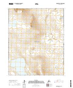
2017 Map of Bendeleben C-3 NE
USGS Topo · Published 2017About this map
Bering Land Bridge National Preserve dominates the interior of this remote landscape on the Seward Peninsula, where volcanic features and extensive water systems define the terrain. The hydrology of the region is centered around Imuruk Lake and Salix Bay to the south, while the northern reaches are marked by the high elevations of Asses Ears and Virginia Butte.
Find a feature on this map
13 named features on this map. Tap any name to fly to it.
Don’t see what you’re looking for? This feature index may not catch every label — zoom into the map to look around manually.
Map Details
Editions of this 2017 Bendeleben C-3 NE Map
This is the sole edition of this map. No revisions or reprints were ever made.
Other maps of this area

1950 · Bendeleben C-3
USGS Topo · 1:63,360

1950 · Bendeleben C-2
USGS Topo · 1:63,360

1950 · Bendeleben D-2
USGS Topo · 1:63,360

1950 · Bendeleben
USGS Topo · 1:250,000

1950 · Bendeleben D-3
USGS Topo · 1:63,360

1951 · Bendeleben
USGS Topo · 1:250,000

1964 · Bendeleben
USGS Topo · 1:250,000
2017 · Bendeleben C-2 SW
USGS Topo · 1:25,000
2017 · Bendeleben C-2 NW
USGS Topo · 1:25,000
2017 · Bendeleben D-2 SW
USGS Topo · 1:25,000