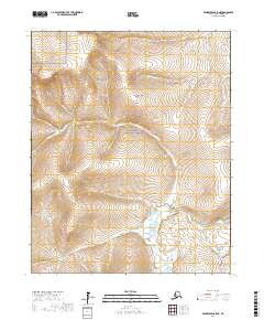
2017 Map of Bendeleben C-5 NE
USGS Topo · Published 2017About this map
The Bering Land Bridge National Preserve encompasses a significant portion of this landscape on the Seward Peninsula, protecting a geography that once served as a vital migration corridor. The Continental Divide winds through the northern sections, dictating the flow of numerous drainages across the terrain. Water is the defining element of this region, with the Noxapaga River meanduring through the southern reaches, joined by a network of tributaries including Jemmie Cr and Aurora Cr. These waterways, along with others like Placer Cr and Sylvanite Cr, highlight the importance of drainage patterns in an area historically defined by its hydrology and natural boundaries.
Find a feature on this map
17 named features on this map. Tap any name to fly to it.
Don’t see what you’re looking for? This feature index may not catch every label — zoom into the map to look around manually.
Map Details
Editions of this 2017 Bendeleben C-5 NE Map
This is the sole edition of this map. No revisions or reprints were ever made.
Other maps of this area

1950 · Bendeleben C-5
USGS Topo · 1:63,360

1950 · Bendeleben C-4
USGS Topo · 1:63,360

1950 · Bendeleben D-5
USGS Topo · 1:63,360

1950 · Bendeleben
USGS Topo · 1:250,000

1950 · Bendeleben D-4
USGS Topo · 1:63,360

1951 · Bendeleben
USGS Topo · 1:250,000

1964 · Bendeleben
USGS Topo · 1:250,000
2014 · Bendeleben C-5 SW
USGS Topo · 1:25,000
2014 · Bendeleben D-5 SW
USGS Topo · 1:25,000
2014 · Bendeleben C-5 NW
USGS Topo · 1:25,000