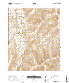
2017 Map of Bendeleben D-1 SW
USGS Topo · Published 2017About this map
The Kugruk River meanders through this portion of the Northwest Arctic Borough, its complex oxbows and shifting channels defining the drainage pattern of the Seward Peninsula interior. This survey illustrates a landscape dominated by high-latitude hydrology, where the primary river system is fed by numerous tributaries including Goldbug Cr, Montana Cr, and Reindeer Cr. The lack of infrastructure or developed settlements underscores the isolation of this region, with the only formal organization appearing in the township and range lines of the Public Land Survey System, such as t5n r18w and t6n r17w. The detailed contour work provided by the U.S. Geological Survey traces the elevation changes from the river valley floors to the surrounding upland divides, capturing the raw geography of the Alaska wilderness in the early 21st century.
Find a feature on this map
12 named features on this map. Tap any name to fly to it.
Don’t see what you’re looking for? This feature index may not catch every label — zoom into the map to look around manually.
Map Details
Editions of this 2017 Bendeleben D-1 SW Map
This is the sole edition of this map. No revisions or reprints were ever made.
Other maps of this area

1950 · Bendeleben C-1
USGS Topo · 1:63,360

1950 · Bendeleben C-2
USGS Topo · 1:63,360

1950 · Bendeleben D-2
USGS Topo · 1:63,360

1950 · Bendeleben
USGS Topo · 1:250,000

1950 · Bendeleben D-1
USGS Topo · 1:63,360

1951 · Bendeleben
USGS Topo · 1:250,000

1964 · Bendeleben
USGS Topo · 1:250,000
2014 · Bendeleben D-1 SE
USGS Topo · 1:25,000
2014 · Bendeleben C-1 NE
USGS Topo · 1:25,000
2017 · Bendeleben D-2 NE
USGS Topo · 1:25,000