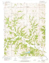
1959 Map of Bendena
USGS Topo · Published 1977About this map
Bendena serves as a central point in this late-1950s landscape, situated along the Chicago Rock Island and Pacific railroad line. The surrounding terrain of Doniphan and Atchison counties is defined by a dendritic drainage pattern where Jordan Creek and Independence Creek have carved deep valleys into the Kansas countryside. The map reveals a high density of rural social infrastructure from a mid-century perspective, including schools like Midway High Sch and Oakland Sch, alongside numerous family or community landmarks such as Bittner Cem and St Benedict Ch. To the south, the establishment of Atchison County State Park indicates the shift toward public recreation and conservation during this era, while the strictly gridded road system reflects the enduring influence of the Public Land Survey System on local development.
Find a feature on this map
23 named features on this map. Tap any name to fly to it.
Don’t see what you’re looking for? This feature index may not catch every label — zoom into the map to look around manually.
Map Details
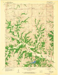
Editions of this 1959 Bendena Map
2 editions found
Other maps of this area

1885 · Atchison
USGS Topo · 1:125,000

1888 · Atchison
USGS Topo · 1:125,000

1893 · Atchison
USGS Topo · 1:125,000

1926 · Atchison
USGS Topo · 1:62,500

1926 · Oregon
USGS Topo · 1:62,500

1950 · Kansas City
USGS Topo · 1:250,000
1951 · Rushville
USGS Topo · 1:24,000

1954 · Kansas City
USGS Topo · 1:250,000

1956 · Kansas City
USGS Topo · 1:250,000
1959 · Sparks
USGS Topo · 1:24,000