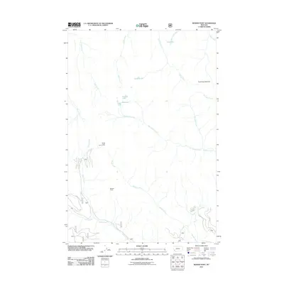
2011 Map of Bender Point
USGS Topo · Published 2011About this map
Bender Forest Service Facility stands as the primary human landmark in this high-altitude landscape of the Bitterroot National Forest, situated north of Bender Creek. The terrain is defined by a dense network of drainage systems, where Hell Roaring Creek and Johnson Creek carve through the topography toward the southwest. This area is notable for its cluster of alpine water bodies, including Surprise Lake, Phlox Lake, and Violet Lake, which gather below the higher ridges. The northeast corner is marked by Buck Ridge Meadows and the secluded Buck Lake. Access to this remote region is provided by a series of Forest Service roads, such as 1137 and 1245, which wind through the elevations near Bender Point. The map captures a wilderness area managed for conservation and resource protection in the early 21st century.
Find a feature on this map
29 named features on this map. Tap any name to fly to it.
Don’t see what you’re looking for? This feature index may not catch every label — zoom into the map to look around manually.
Map Details
Editions of this 2011 Bender Point Map
This is the sole edition of this map. No revisions or reprints were ever made.
Other maps of this area

1955 · Dillon
USGS Topo · 1:250,000

1957 · Dillon
USGS Topo · 1:250,000

1958 · Dillon
USGS Topo · 1:250,000

1962 · Dillon
USGS Topo · 1:250,000

1965 · Dillon
USGS Topo · 1:250,000

1966 · Gibbons School
USGS Topo · 1:24,000

1966 · Big Hole Battlefield
USGS Topo · 1:24,000
1966 · Elk Creek
USGS Topo · 1:24,000
1974 · Bender Point
USGS Topo · 1:24,000
1974 · Lick Creek
USGS Topo · 1:24,000