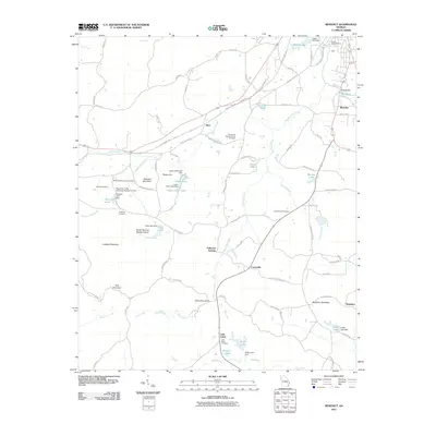
2011 Map of Benedict
USGS Topo · Published 2011About this map
Benedict and its surrounding hamlets are defined by the convergence of the Silver Comet Trl and a landscape of ridges and creek valleys. This 2011 survey documents the rural character of Polk County, where industrial history persists at the Woodward Mine and Benedicts Mill. The area's genealogical depth is evident in the numerous burial grounds, including the South Side Cemetery, Little Creek Cemetery, and the Shiloh Baptist Church Cemetery, which anchor the small communities of Akes, Caseyville, and Fullwood Springs.
Find a feature on this map
95 named features on this map. Tap any name to fly to it.
Don’t see what you’re looking for? This feature index may not catch every label — zoom into the map to look around manually.
Map Details
Editions of this 2011 Benedict Map
This is the sole edition of this map. No revisions or reprints were ever made.
Other maps of this area

1886 · Rome
USGS Topo · 1:125,000

1889 · Tallapoosa
USGS Topo · 1:125,000

1892 · Tallapoosa
USGS Topo · 1:125,000

1897 · Tallapoosa
USGS Topo · 1:125,000

1898 · Rome
USGS Topo · 1:125,000

1899 · Rome
USGS Topo · 1:125,000

1904 · Rome
USGS Topo · 1:125,000

1953 · Atlanta
USGS Topo · 1:250,000

1955 · Rome
USGS Topo · 1:250,000

1957 · Atlanta
USGS Topo · 1:250,000