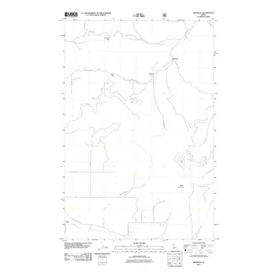
2011 Map of Benewah
USGS Topo · Published 2011About this map
Benewah serves as the focal point of this northern Idaho landscape, situated along the upper reaches of Benewah Creek. The terrain is defined by significant drainage systems and high passes that have historically dictated movement through the region, most notably Windfall Pass and Lolo Pass. To the south, Moses Mountain dominates the local topography, overlooking a network of seasonal and permanent watercourses including Nehchen Creek and Hangman Creek. The map documents a landscape where traditional indigenous place names persist alongside later descriptive labels, as seen in the Ni'nsi' Meadow and Hnp ekwle n Meadow. A modest network of forest and local roads like Benewah Creek Rd and Old Sanders Rd provides access to the backcountry, reflecting a modern era of land management and recreation in these high valleys.
Find a feature on this map
30 named features on this map. Tap any name to fly to it.
Don’t see what you’re looking for? This feature index may not catch every label — zoom into the map to look around manually.
Map Details
Editions of this 2011 Benewah Map
This is the sole edition of this map. No revisions or reprints were ever made.
Other maps of this area

1955 · Spokane
USGS Topo · 1:250,000

1957 · St. Maries
USGS Topo · 1:62,500

1957 · Emida
USGS Topo · 1:62,500

1957 · Plummer
USGS Topo · 1:62,500

1957 · Tensed
USGS Topo · 1:62,500

1958 · Spokane
USGS Topo · 1:250,000

1975 · Plummer SE
USGS Topo · 1:24,000

1981 · St Maries
USGS Topo · 1:100,000
1981 · Benewah Lake
USGS Topo · 1:24,000
1981 · Plummer
USGS Topo · 1:24,000