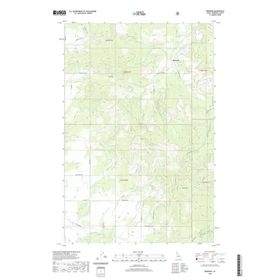
2020 Map of Benewah
USGS Topo · Published 2020About this map
Benewah occupies a high-elevation drainage network in the northern Idaho panhandle, where the landscape is defined by the divides between major local creek systems. This 2020 survey illustrates a region largely shaped by forestry and rural land management, centered on the prominent peak of Moses Mtn. A network of logging and access roads, including Benewah Creek Rd and Windfall Pass Rd, provides the primary infrastructure through the timbered terrain.
Find a feature on this map
42 named features on this map. Tap any name to fly to it.
Don’t see what you’re looking for? This feature index may not catch every label — zoom into the map to look around manually.
Map Details
Editions of this 2020 Benewah Map
This is the sole edition of this map. No revisions or reprints were ever made.
Other maps of this area

1955 · Spokane
USGS Topo · 1:250,000

1957 · St. Maries
USGS Topo · 1:62,500

1957 · Emida
USGS Topo · 1:62,500

1957 · Plummer
USGS Topo · 1:62,500

1957 · Tensed
USGS Topo · 1:62,500

1958 · Spokane
USGS Topo · 1:250,000

1975 · Plummer SE
USGS Topo · 1:24,000

1981 · St Maries
USGS Topo · 1:100,000
1981 · Benewah Lake
USGS Topo · 1:24,000
1981 · Plummer
USGS Topo · 1:24,000