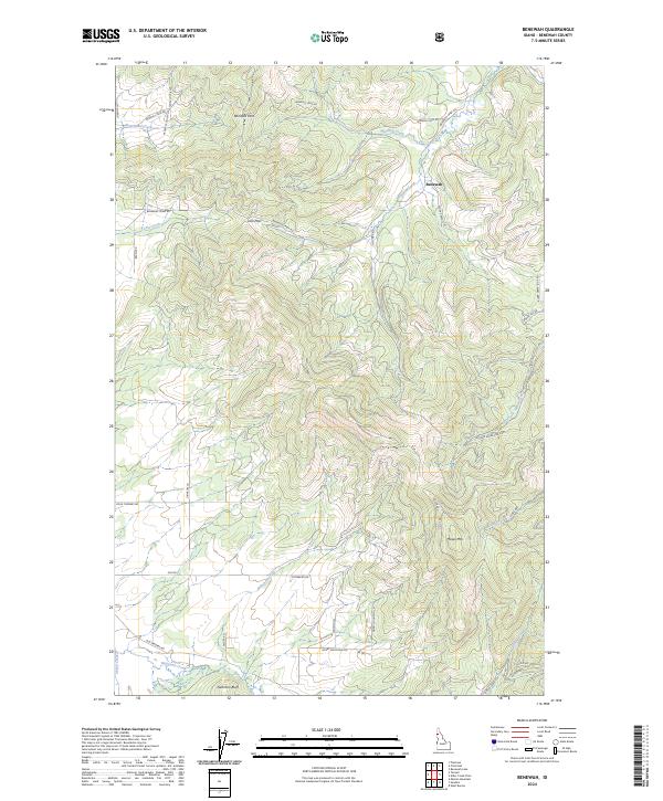
2024 Map of Benewah
USGS Topo · Published 2024About this map
Benewah occupies a landscape of steep timbered drainages and prominent mountain passes in northern Idaho. The terrain is defined by the high elevations of Moses Mtn and the steep incline of Nehchen Bluff, with water moving through a complex network of creeks including Hangman Creek, Benewah Creek, and Moctileme Creek. Transportation patterns here reflect the challenging topography, centered on historic routes over Windfall Pass and Lolo Pass. A dense network of forest roads and local lanes, such as Alder Creek Rd and Osterberg Rd, provide access to the various sections of these mountain townships. The map illustrates how human movement is strictly dictated by the drainage basins of North Fork Alder Creek and Indian Creek, where roads follow the natural contours of the land rather than a rigid grid.
Find a feature on this map
46 named features on this map. Tap any name to fly to it.
Don’t see what you’re looking for? This feature index may not catch every label — zoom into the map to look around manually.
Map Details
Editions of this 2024 Benewah Map
This is the sole edition of this map. No revisions or reprints were ever made.
Other maps of this area

1955 · Spokane
USGS Topo · 1:250,000

1957 · St. Maries
USGS Topo · 1:62,500

1957 · Emida
USGS Topo · 1:62,500

1957 · Plummer
USGS Topo · 1:62,500

1957 · Tensed
USGS Topo · 1:62,500

1958 · Spokane
USGS Topo · 1:250,000

1975 · Plummer SE
USGS Topo · 1:24,000

1981 · St Maries
USGS Topo · 1:100,000
1981 · Benewah Lake
USGS Topo · 1:24,000
1981 · Plummer
USGS Topo · 1:24,000