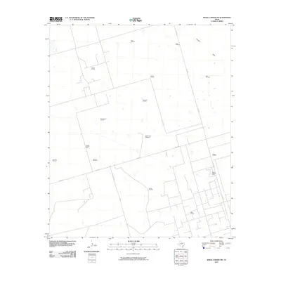
2010 Map of Benge Corner NW
USGS Topo · Published 2010About this map
The Pegasus Gasoline Plant and its surrounding energy infrastructure define this West Texas landscape at the start of the 21st century. This region of Midland County is a patchwork of industrial development and ranching history, where the Pegasus Oil Field, Warsaw Oil Field, and Sweetie Peck Oil Field dominate the terrain. The map reveals an intricate network of service roads and pipelines supporting the extraction economy, yet older landmarks remain essential to the territory's utility. A dense collection of named water sources and specialized sites, such as the Eagles Nest Gliderport and the Shearing Pen Windmill, suggests a dual use of the land where aviation and livestock management coexist alongside heavy industry. The drainage of Johnson Draw cuts across the northeastern sector, providing a natural contrast to the geometric grid of oil pads and FM 1788 S.
Find a feature on this map
21 named features on this map. Tap any name to fly to it.
Don’t see what you’re looking for? This feature index may not catch every label — zoom into the map to look around manually.
Map Details
Editions of this 2010 Benge Corner NW Map
This is the sole edition of this map. No revisions or reprints were ever made.
Other maps of this area

1954 · Pecos
USGS Topo · 1:250,000

1957 · Pecos
USGS Topo · 1:250,000

1964 · Bryant Ranch
USGS Topo · 1:24,000

1964 · Odessa SE
USGS Topo · 1:24,000

1964 · Parks
USGS Topo · 1:24,000

1964 · Perkins Lake
USGS Topo · 1:24,000

1965 · South Cowden Ranch
USGS Topo · 1:24,000

1968 · Benge Corner SE
USGS Topo · 1:24,000

1968 · Benge Corner NW
USGS Topo · 1:24,000

1968 · Benge Corner SW
USGS Topo · 1:24,000