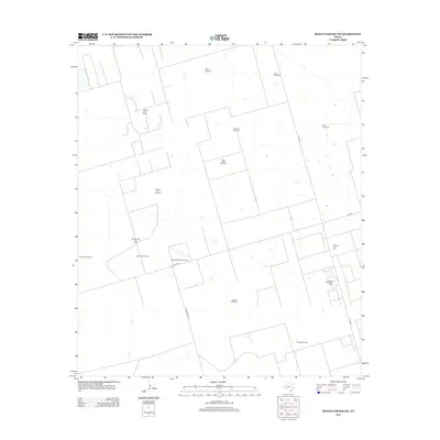
2012 Map of Benge Corner NW
USGS Topo · Published 2012About this map
The Warsaw Oil Field and Pegasus Oil Field dominate this section of the Permian Basin, revealing an industrial landscape defined by energy extraction. This 2012 survey illustrates the dense network of service roads and pipelines required to support the local economy, centered around the Pegasus Gasoline Plant. While modern industry is prominent, the persistence of numerous family-named and descriptive water sources like the Dog Town Windmill, Shearing Pen Windmill, and Bull Head Windmill reflects the area's continued reliance on groundwater for ranching operations. The presence of the Eagles Nest Gliderport near the junction of FM-1787 and Ranch Road 1492 adds a distinct recreational aviation element to an otherwise strictly utilitarian landscape of wells and windmills.
Find a feature on this map
18 named features on this map. Tap any name to fly to it.
Don’t see what you’re looking for? This feature index may not catch every label — zoom into the map to look around manually.
Map Details
Editions of this 2012 Benge Corner NW Map
This is the sole edition of this map. No revisions or reprints were ever made.
Other maps of this area

1954 · Pecos
USGS Topo · 1:250,000

1957 · Pecos
USGS Topo · 1:250,000

1964 · Bryant Ranch
USGS Topo · 1:24,000

1964 · Odessa SE
USGS Topo · 1:24,000

1964 · Parks
USGS Topo · 1:24,000

1964 · Perkins Lake
USGS Topo · 1:24,000

1965 · South Cowden Ranch
USGS Topo · 1:24,000

1968 · Benge Corner SE
USGS Topo · 1:24,000

1968 · Benge Corner NW
USGS Topo · 1:24,000

1968 · Benge Corner SW
USGS Topo · 1:24,000