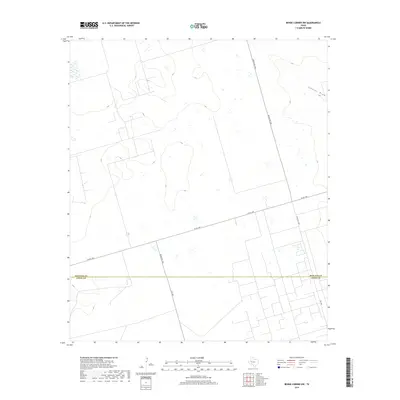
2019 Map of Benge Corner NW
USGS Topo · Published 2019About this map
Johnson Draw winds through this West Texas landscape, providing a rare hydrological feature in a region defined by its wide-open ranching and energy infrastructure. The survey area straddles the significant administrative boundary between Midland Co and Upton Co, capturing the intersection of major transit routes including Ranch Rd 1788 and W FM 1787. This 2019 edition illustrates the methodical development of the Permian Basin, where the geometric grid of access roads like Ranch Rd 1492 overlays the natural drainage patterns. The map is a valuable resource for understanding contemporary land use and the rural road network connecting these two important petroleum-producing counties.
Find a feature on this map
7 named features on this map. Tap any name to fly to it.
Don’t see what you’re looking for? This feature index may not catch every label — zoom into the map to look around manually.
Map Details
Editions of this 2019 Benge Corner NW Map
This is the sole edition of this map. No revisions or reprints were ever made.
Other maps of this area

1954 · Pecos
USGS Topo · 1:250,000

1957 · Pecos
USGS Topo · 1:250,000

1964 · Bryant Ranch
USGS Topo · 1:24,000

1964 · Odessa SE
USGS Topo · 1:24,000

1964 · Parks
USGS Topo · 1:24,000

1964 · Perkins Lake
USGS Topo · 1:24,000

1965 · South Cowden Ranch
USGS Topo · 1:24,000

1968 · Benge Corner SE
USGS Topo · 1:24,000

1968 · Benge Corner NW
USGS Topo · 1:24,000

1968 · Benge Corner SW
USGS Topo · 1:24,000