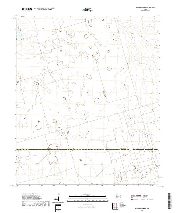
2022 Map of Benge Corner NW
USGS Topo · Published 2022About this map
Midland Co and Upton Co meet along a straight east-west boundary in this section of the Permian Basin, where the landscape is defined by the ephemeral drainage of Johnson Draw. The terrain is characterized by a network of ranch-to-market and farm-to-market roads, reflecting the infrastructure required for the regional energy and ranching sectors. The geometric grid of secondary routes, including Ranch Rd 1788 and W FM 1787, bisects the arid flats and gentle depressions that mark this West Texas plateau. The path of Ranch Rd 1492 cuts through the center of the sheet, providing a primary north-south artery through the sparse, industrial-agricultural landscape typical of this portion of the Llano Estacado.
Find a feature on this map
7 named features on this map. Tap any name to fly to it.
Don’t see what you’re looking for? This feature index may not catch every label — zoom into the map to look around manually.
Map Details
Editions of this 2022 Benge Corner NW Map
This is the sole edition of this map. No revisions or reprints were ever made.
Other maps of this area

1954 · Pecos
USGS Topo · 1:250,000

1957 · Pecos
USGS Topo · 1:250,000

1964 · Bryant Ranch
USGS Topo · 1:24,000

1964 · Odessa SE
USGS Topo · 1:24,000

1964 · Parks
USGS Topo · 1:24,000

1964 · Perkins Lake
USGS Topo · 1:24,000

1965 · South Cowden Ranch
USGS Topo · 1:24,000

1968 · Benge Corner SE
USGS Topo · 1:24,000

1968 · Benge Corner NW
USGS Topo · 1:24,000

1968 · Benge Corner SW
USGS Topo · 1:24,000