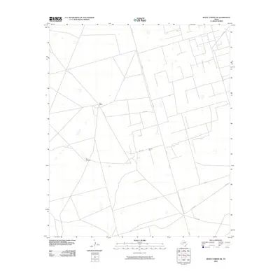
2010 Map of Benge Corner SW
USGS Topo · Published 2010About this map
Davis Oil Field and the Barr Ranch define the sparsely settled landscape of Upton County, Texas, as it appeared in the early 21st century. The map reveals a grid-like network of county roads, including Co RD 308 and Co RD 310, which service the local petroleum and ranching industries. Isolated landmarks like the Bug Windmill dot the terrain, marking critical water sources in an otherwise arid expanse. The path of FM 1492 cuts through the center of the sheet, providing a primary connection for the heavy equipment and ranch vehicles that traverse this portion of the Permian Basin. This survey preserves the exact location of family-named ranch boundaries and specific oil infrastructure during a period of ongoing energy production in West Texas.
Find a feature on this map
9 named features on this map. Tap any name to fly to it.
Don’t see what you’re looking for? This feature index may not catch every label — zoom into the map to look around manually.
Map Details
Editions of this 2010 Benge Corner SW Map
This is the sole edition of this map. No revisions or reprints were ever made.
Other maps of this area

1928 · Crane
USGS Topo · 1:125,000

1954 · Pecos
USGS Topo · 1:250,000

1957 · Pecos
USGS Topo · 1:250,000

1964 · Perkins Lake
USGS Topo · 1:24,000

1965 · South Cowden Ranch
USGS Topo · 1:24,000

1968 · Benge Corner SE
USGS Topo · 1:24,000

1968 · Benge Corner NW
USGS Topo · 1:24,000

1968 · Benge Corner SW
USGS Topo · 1:24,000
1968 · Benge Corner
USGS Topo · 1:24,000
1971 · Hanks Ranch
USGS Topo · 1:24,000