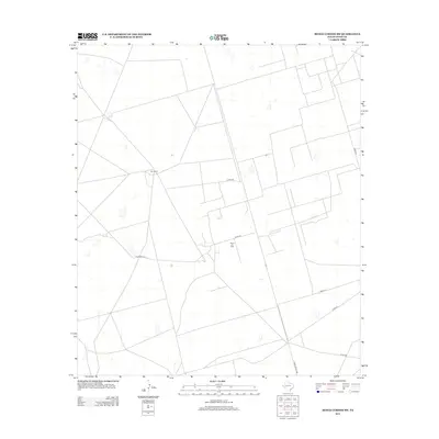
2012 Map of Benge Corner SW
USGS Topo · Published 2012About this map
Barr Ranch and the industrial infrastructure of the Davis Oil Field anchor this portion of Upton County during the early 21st century. The landscape is defined by a sparse but functional grid of petroleum and ranching transit routes, including Ranch Road 1492 and several designated county roads like Co Rd-310. Small-scale features such as Bug Windmill reflect the traditional water management practices necessary for livestock in this arid Texas environment, standing in contrast to the modern energy extraction footprint. The network of unimproved roads and oil field tracks reveals a land primarily dedicated to resource production and large-scale ranching, where isolated landmarks serve as essential reference points in a high-desert terrain.
Find a feature on this map
9 named features on this map. Tap any name to fly to it.
Don’t see what you’re looking for? This feature index may not catch every label — zoom into the map to look around manually.
Map Details
Editions of this 2012 Benge Corner SW Map
This is the sole edition of this map. No revisions or reprints were ever made.
Other maps of this area

1928 · Crane
USGS Topo · 1:125,000

1954 · Pecos
USGS Topo · 1:250,000

1957 · Pecos
USGS Topo · 1:250,000

1964 · Perkins Lake
USGS Topo · 1:24,000

1965 · South Cowden Ranch
USGS Topo · 1:24,000

1968 · Benge Corner SE
USGS Topo · 1:24,000

1968 · Benge Corner NW
USGS Topo · 1:24,000

1968 · Benge Corner SW
USGS Topo · 1:24,000
1968 · Benge Corner
USGS Topo · 1:24,000
1971 · Hanks Ranch
USGS Topo · 1:24,000