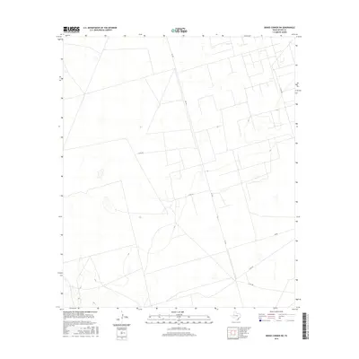
2016 Map of Benge Corner SW
USGS Topo · Published 2016About this map
Upton County ranching lands and oil field access routes define this corner of West Texas in the mid-2010s. The landscape is structured by a rectilinear grid of property boundaries and service roads, most notably FM 1492 which provides the primary north-south transit through the area. Local connectivity is maintained through a network of county roads including Co Rd 308 and Co Rd 309, which likely serve the scattered energy infrastructure and agricultural interests common to this region. The terrain is marked by gentle topographic variations and ephemeral wetland features, characteristic of the Permian Basin's high plains. These survey details from the U.S. Geological Survey record the modern road network, including Co Rd 310, before further industrial development or land use changes occurred.
Find a feature on this map
6 named features on this map. Tap any name to fly to it.
Don’t see what you’re looking for? This feature index may not catch every label — zoom into the map to look around manually.
Map Details
Editions of this 2016 Benge Corner SW Map
This is the sole edition of this map. No revisions or reprints were ever made.
Other maps of this area

1928 · Crane
USGS Topo · 1:125,000

1954 · Pecos
USGS Topo · 1:250,000

1957 · Pecos
USGS Topo · 1:250,000

1964 · Perkins Lake
USGS Topo · 1:24,000

1965 · South Cowden Ranch
USGS Topo · 1:24,000

1968 · Benge Corner SE
USGS Topo · 1:24,000

1968 · Benge Corner NW
USGS Topo · 1:24,000

1968 · Benge Corner SW
USGS Topo · 1:24,000
1968 · Benge Corner
USGS Topo · 1:24,000
1971 · Hanks Ranch
USGS Topo · 1:24,000