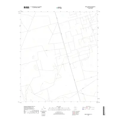
2019 Map of Benge Corner SW
USGS Topo · Published 2019About this map
Fm 1492 bisects this portion of Upton County, serving as the primary north-south artery through a landscape defined by expansive rural tracts and a network of county roads. The mapping reveals a sparse but deliberate infrastructure characteristic of the Texas Permian Basin region, where transportation routes like Co Rd 309 and Co Rd 310 provide access across wide open terrain. While the area lacks named settlements or major landmarks, the road patterns and elevation contours indicate a working landscape shaped by regional ranching or resource extraction needs. Topographical details captured by the U.S. Geological Survey show a series of intermittent water features and depressions scattered among the larger parcels, illustrating the arid hydrology of the West Texas plains in the early twenty-first century.
Find a feature on this map
7 named features on this map. Tap any name to fly to it.
Don’t see what you’re looking for? This feature index may not catch every label — zoom into the map to look around manually.
Map Details
Editions of this 2019 Benge Corner SW Map
This is the sole edition of this map. No revisions or reprints were ever made.
Other maps of this area

1928 · Crane
USGS Topo · 1:125,000

1954 · Pecos
USGS Topo · 1:250,000

1957 · Pecos
USGS Topo · 1:250,000

1964 · Perkins Lake
USGS Topo · 1:24,000

1965 · South Cowden Ranch
USGS Topo · 1:24,000

1968 · Benge Corner SE
USGS Topo · 1:24,000

1968 · Benge Corner NW
USGS Topo · 1:24,000

1968 · Benge Corner SW
USGS Topo · 1:24,000
1968 · Benge Corner
USGS Topo · 1:24,000
1971 · Hanks Ranch
USGS Topo · 1:24,000