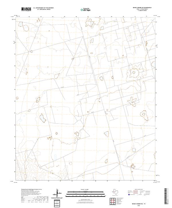
2022 Map of Benge Corner SW
USGS Topo · Published 2022About this map
Upton County terrain is mapped here during a contemporary period of land use, characterized by a sparse network of ranch and county roads. The landscape is defined by its gradual topographical shifts and a collection of intermittent water features or depressions typical of West Texas. Transport across this rural section is facilitated by FM 1492, which acts as the primary north-south artery. Branching from this route, several local connectors including Co Rd 309 and Co Rd 310 provide access to the interior parcels. The presence of routes like Co Rd 307 and Co Rd 308 suggest a landscape structured around long-standing land divisions and localized travel between neighboring ranches.
Find a feature on this map
6 named features on this map. Tap any name to fly to it.
Don’t see what you’re looking for? This feature index may not catch every label — zoom into the map to look around manually.
Map Details
Editions of this 2022 Benge Corner SW Map
This is the sole edition of this map. No revisions or reprints were ever made.
Other maps of this area

1928 · Crane
USGS Topo · 1:125,000

1954 · Pecos
USGS Topo · 1:250,000

1957 · Pecos
USGS Topo · 1:250,000

1964 · Perkins Lake
USGS Topo · 1:24,000

1965 · South Cowden Ranch
USGS Topo · 1:24,000

1968 · Benge Corner SE
USGS Topo · 1:24,000

1968 · Benge Corner NW
USGS Topo · 1:24,000

1968 · Benge Corner SW
USGS Topo · 1:24,000
1968 · Benge Corner
USGS Topo · 1:24,000
1971 · Hanks Ranch
USGS Topo · 1:24,000